These two projects take our tour of the Salisbury sites into Gore’s Chequer, which fronted onto Endless Street and Rollestone Street. The two sites, which were approximately 80 m south from last week’s site, were of considerable interest. William Naish, who published one of the first surveys of the city in 1716, indicated that the strip of land at the north end of the chequer was open, suggesting that it may never have been developed; blocks of this type which remained vacant over long periods are rare in Salisbury.
The watching brief in Endless Street was requested by Wiltshire Council as a condition of planning consent during work to refurbish and extend the premises to residential use. The work was limited, involving three small, shallow excavated areas, which were not expected to produce any major discoveries; however, results were surprisingly productive, fully justifying the decision to request that the work should be done.
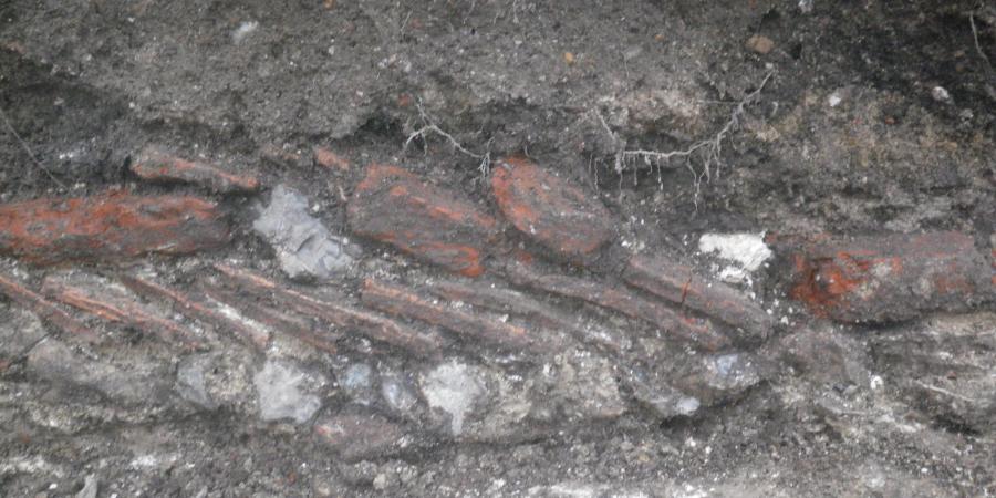
The north boundary of No 24, which formed the south border of the ‘open’ plot, was marked by a previously unrecorded late medieval or early post medieval tenement foundation. It was constructed of flint, chalk, pitched roof tiles and Greensand blocks, all components of medieval building, but included fragments of brick, which became more popular in the 17th century.
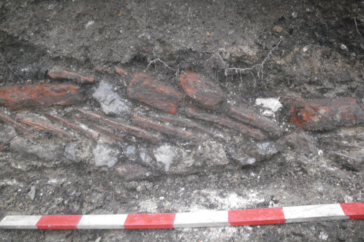
The foundation could be traced for a length of approximately 5 m and survived to a height of three courses. Similar foundations with Greensand blocks have been found elsewhere in the city and possibly functioned to support uprights for a timber framed building. So, it is possible that apart from marking the tenement boundary it may also have formed part of a service range at the back of the property.
The southern tenement boundary comprised a 19th century brick wall with recycled limestone block foundations. Some gravestone fragments were also found, which revealed an intriguing and possibly tragic human story, reflecting life for ordinary people in 18th century Salisbury. The principal name on the headstone refers to Mary, wife of Andrew Randall.
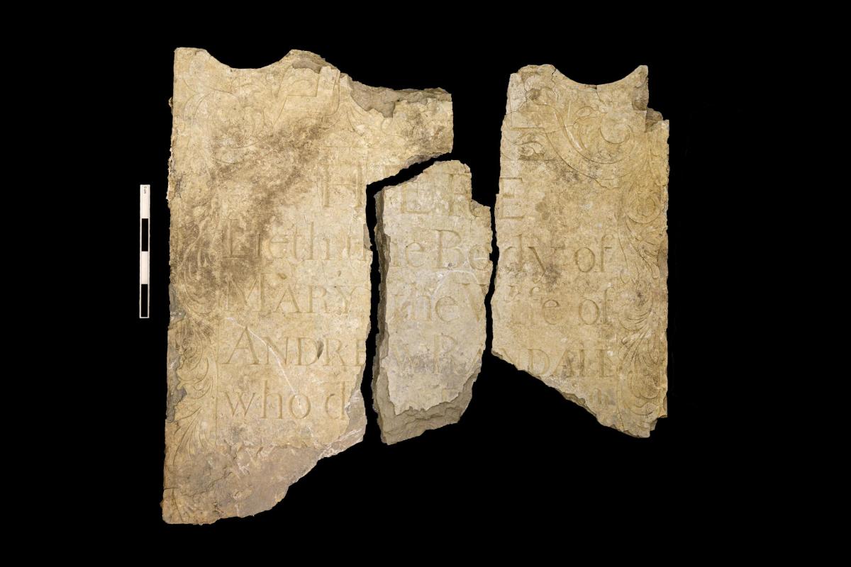
Genealogical searches provided a plausible link between Mary Burr who married Andrew Randoll in October 1727 at St. Edmund’s Church. Andrew was buried there in November 1753 followed shortly after by Mary in December. Two children, both with the name Randoll, also died in December. We may never know precisely how these deaths were linked, however small pox was endemic in the 18th century, including an especially severe outbreak in 1752. The story does not end there. It is possible that the headstone in memory of Mary was removed, broken and recycled with no due respect to Endless Street when the church was renovated in the late-18th century or re-modelled by Sir Gilbert Scott in 1865-7.
This project can be linked to earlier work on the site when three evaluation trenches, each 10m long and 2m wide, were dug by Wessex Archaeology, on the opposite side of the chequer at the north end of Rollestone Street.
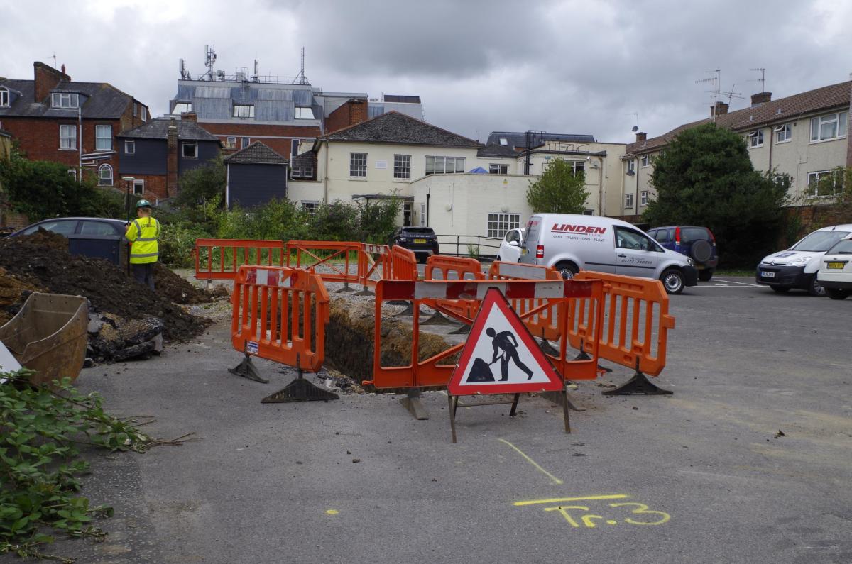
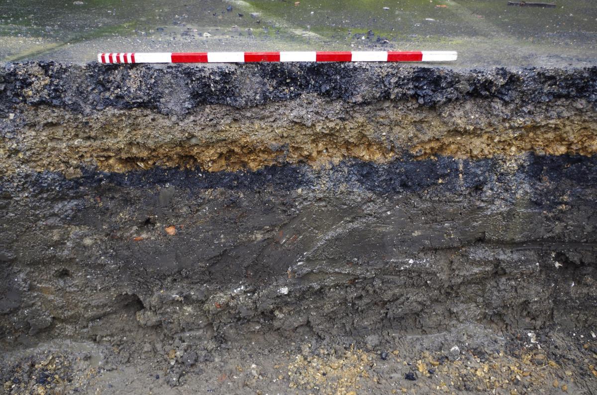
One trench was placed specifically to locate foundations of any buildings along the street frontage. All trenches encountered accumulations of soil that, like those seen at Belle Vue House, typify the back-lands in Salisbury. The results therefore appear to corroborate the mapping of Naish which indicates that this part of Gore Chequer was one of those that has remained relatively undeveloped to the present day.