
Wessex Archaeology was commissioned by Teesland Development Company, Kennet Properties and the London Borough of Enfield to undertake a series of archaeological investigations at the former Rammey Marsh Sewage Treatment Works, Enfield, London.
The archaeological investigations were required as part of the planning consent for the construction of industrial units in the north and small business properties in the south of the former sewage works, now known respectively as Innova Park and Innova Science Park
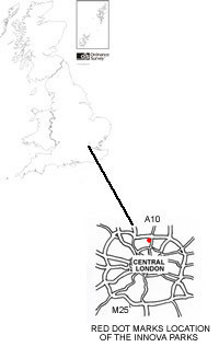
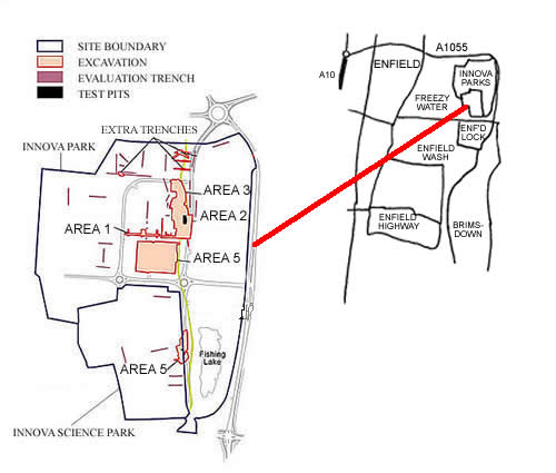
The area of the former Sewage Works covers some 61 hectares situated on low-lying land to the west of the present course of the River Lea, which forms the boundary between the county of Essex and the Greater London Borough of Enfield.
The archaeological works started in 1997 and consisted of 5 main areas of excavation and several episodes of evaluation trenching. This comprised a total of 91 trenches ranging from 5x1m to 75x2m in size. The excavations covered a total area of 22437m² or 2.244 hectares. The earth removed from the areas of the excavations weighed approximately 5609 tonnes.
Or why not experience the site as the archaeologists who excavated it did, follow their discoveries and interpretations area by area?
See how the information from successive excavations builds up a detailed picture of what happened in just one small area over two millennia! Area 1
Overview: The Lea Valley

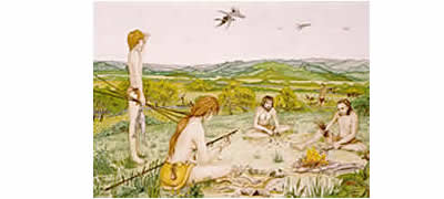
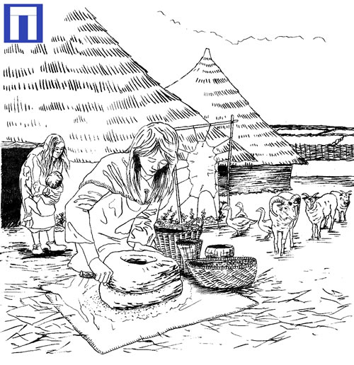
Innova Park lies on the west of the river Lea, beside what may have been one of its former channels. The present industrial and urban character of the lower Lea Valley marks only the latest stage in a constantly evolving landscape. Occasional finds, such as flint tools and a mammoth tusk from nearby Enfield Lock, indicate at least an occasional human presence during the warmer parts of the last Ice Age.
Since then the major feature in the landscape has been the River Lea and its associated wetland, pasture, marsh, and tributary streams. For much of that period, people have exploited the valley for raw materials, food and grazing land.
The Bronze Age
The first period of intensive activity on site dates to the middle Bronze Age (1500-1100 BC). (A scatter of pits and a gully sealed beneath a Bronze Age layer must be earlier, but cannot be dated accurately).
A concentration of pits, post-holes and ditches indicates activity over a long period of time. However, a lack of houses suggests this may just have been seasonal encampments. Adjacent to the stream was an unusual area where soil had gradually accumulated, containing quantities of pottery, human bone, animal bone, bone tools and flint tools of Middle and Late Bronze Age types. Ongoing analyses will determine if this is a midden.

Some pits from this period were within the base of the palaeochannel, indicating episodes of reduced water flow, perhaps drought. Of great interest were several phases of revetment made of thick, well-worked timber stakes. These appeared to have been placed to stop erosion of the channel bank or facilitate access to the watercourse. These were originally thought to date from the Romano-British period. Surprisingly, however, radiocarbon dates from the surviving timbers told a different story. They have enabled us to identify at least three different phases of revetment, dating from the Early to Late Bronze Age, spanning up to 700 years (1750 – 1050 BC) and giving us strong evidence for the continued use of the area.
Two Late Bronze Age ditches defined a droveway for leading livestock towards the stream, hinting at the importance of the local water resource. Plant remains found in soil samples indicate the use of other wet-land resources, as well as evidence for grain processing and the collection of fruits and nuts from wild plants.
It is possible that there was a more permanent settlement to the west of the excavated site.
The Iron Age
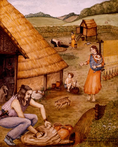
During the Iron Age the area was still used, although perhaps by fewer people, indicated by a small number of pits and gullies as well as an area of lazy beds. Most importantly, it is in the late Iron Age that the first evidence of a permanent settlement is found, a round house.
Pits and post-holes within the building suggest internal storage areas and possible divisions of space. Occupation may have continued into the early Roman period.
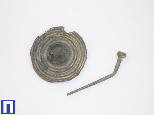
Within the palaeochannel, at least five small circular 'hoops' built from crudely worked twigs and branches probably functioned as fish traps. Although on-site dating was not possible, radiocarbon dating of the wood (170 BC – AD 10) places these in the middle to late Iron Age, not as previously thought in the Roman period.
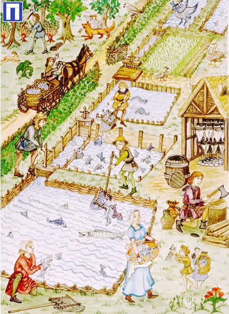
The Romans
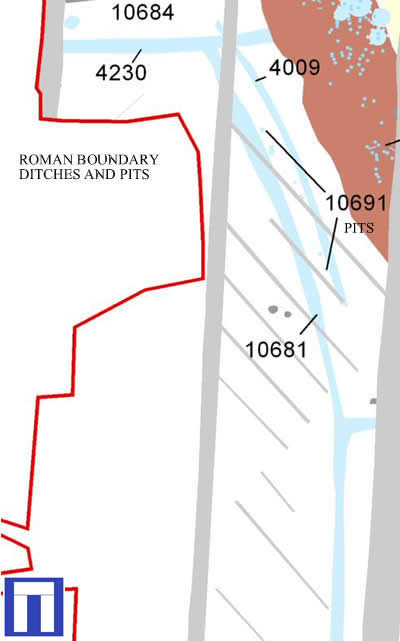
Whilst this period of history is described as Roman we must always remember that although the Romans did invade, life for most people carried on in much the same way as before. Most of the features were ditches for drainage, land division and stock control. The plan (left) shows just such uses with ditch (10681), which was used as a boundary and for drainage. Then to the east of this are 7 post-pits (10691) and another ditch (4009) that may have been a fence for stock control.
Area 1
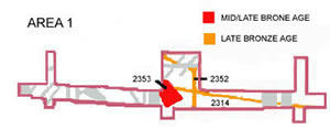
This area of excavation revealed only prehistoric activity. The earliest evidence is a large but shallow hollow (2353) on plan, dated to the mid-late Bronze Age (1500-700 BC). Whilst its use is unclear it does tell us when people first began to visit or use this area.
We know that this interest in the area continued throughout the Bronze Age. The presence of late Bronze Age fields and ditches, shown on the plan above, confirm this.
Area 2

This area of excavation contained the earliest archaeological evidence from across the whole modern development. There were clusters of middle Bronze Age (1500-1100 BC) pits which may represent a small episode of human activity close to a palaeochannel some 3500 years ago.
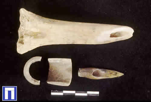
The area is of great interest due to the presence of an unusual deposit which could have been a midden. This built up over a long time and contained pottery, human bone, animal bone, bone tools and flint tools of middle and late Bronze Age types. Bronze Age activity within the area continues right through into the later part of the period (up to 700 BC) with two small ditches being dug to define the area around the midden.
Plans showing all the archaeological remains in Area 2


Area 3
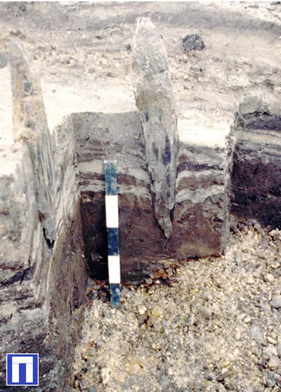
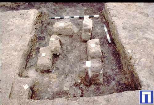
This area of excavation contained a range of archaeological remains. The fact that some of the features occurred within the palaeochannel is of great interest. These features probably represent timber revetments to minimise erosion of the channel bank. The structures were made of thick well-worked timber stakes, several of which partially survive, forming several phases of revetment. They were positioned at a point within the channel where water erosion would be greatest. The exact date of these is unkown but they are believed to be Roman. However samples will be sent for Radiocarbon dating to confirm this (see overview).
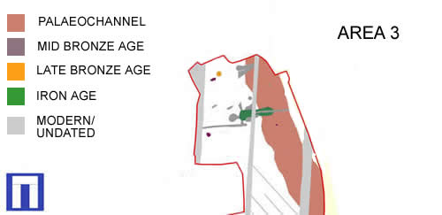
Most of the Roman features were ditches that probably relate to drainage, land division and stock control. The plan to the right shows just such a ditch (10681) which was used as a boundary or for drainage and quite possibly both.Then immediately to the east of this is a series of 7 post-pits (10691) and another ditch (4009) that may have supported a fence for stock control (see plan in overview of Romans).
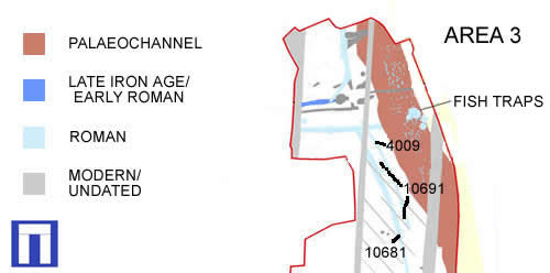
Finally there were at least five circular 'hoops' built from crudely worked twigs and branches, which may have been fish traps. These were located within the palaeochannel in or near the narrowed section of revetments. On-site dating was not possible so samples have been sent for Radiocarbon dating (see overview).

Area 4
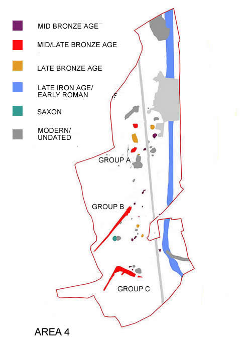
A large number of features dating to the mid/late Bronze Age (1500-700 BC) were identified within this phase of excavation. These suggest activity in the area over a long period of time, possibly in the form of seasonal encampment. Two large ditches may represent the remnants of field boundaries or enclosures and over 60 pits, which form 3 discreet groups (A,B,C on the plan). These may be the result of 3 different episodes of short-term use.
Area 5

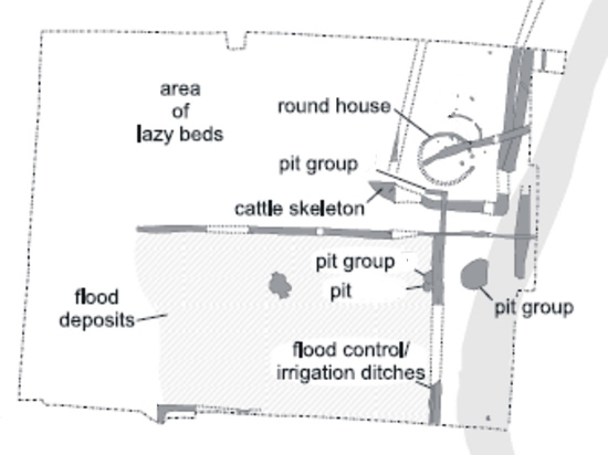
This area was a focal point for late Bronze Age (1100-700 BC) activity on the site. In the first part of the Late Bronze Age a row of pits appear to form a field boundary. Later two ditches (10671)(10672) form an avenue or possible droveway leading towards the palaeochannel. This activity seems to have led to a continued use of the space within the Iron Age (700 BC-100 AD), where Iron Age ‘lazy beds’ can be seen to overlay the Bronze Age features.

We find our first conclusive signs of settlement, dating from the Late Iron Age/Early Roman period. This is shown by the presence of foundations from a roundhouse. Pits and post-holes within the roundhouse suggest internal storage areas and possible divisions of space.
Two contemporary groups of pits (10693)(10688) to the south of the roundhouse are thought to have been used for some form of industrial activity. Ditches within this area were not only boundaries and enclosures but also part of a system of water management/flood control.
