Web mapping has now been made even easier by the advent of platforms such as Google My Maps where it is possible to create layers from scratch or easily overlay any KML (Keyhole Markup Language) file or GeoRSS feed over Google Maps, all done through an easy to use web interface.
 A new site, Geocommons.com from FortiusOne, takes the concept of web mapping a step further by not only providing an online mapping application called Maker but also a spatial data library or warehouse complete with search tools called Finder. Together, Finder and Maker allow non-specialist users to quickly and easily load their own spatial data or find relevant data from the warehouse and then produce cartographically appealing maps in minutes. Data can be uploaded by registered users in simple table format for points or as shapefiles or KML for more complex geometry.
The Finder and data warehouse are an exciting development. For the first time, layers of geographic information can be uploaded and published using Creative Commons licensing. Tags are used to describe and find resources. A bit like Flickr, Scribd or YouTube but for spatial data rather than photos, documents or videos. Any data which is in the public domain is allowed to be uploaded with the onus firmly on the uploader to ensure any copyright or intellectual property conditions are met. With only this small caveat, any layer uploaded is instantly available to any registered user to create a map from. There are also enterprise options for business users to allow them to keep their data private, the aim here presumably being to make inroads into what has till now been the preserve of heavyweight desktop GIS applications.
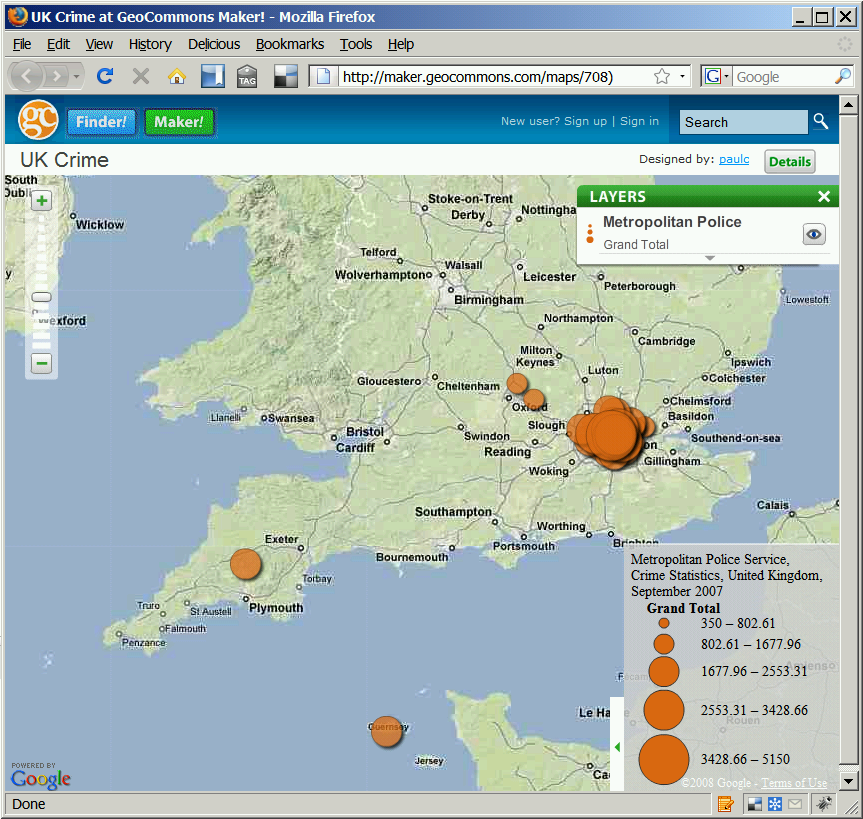
The map Maker side of things provides the same kind of functionality as other online map creation tools but with the benefit of seamless integration with the Finder and everything being controlled through an intuitive graphical interface in the web browser. So any layer in the Finder can easily be added to a map and styled with only a few clicks with a choice of basemaps from Google Maps. In addition to simple maps showing locations of points of interest, lines or polygons with fairly basic symbology, Maker provides users with more advanced cartographic tools for producing thematic maps more akin to the sorts of thematic maps produced using desktop GIS but without the need for any in-depth background knowledge of GIS applications, programming, markup or anything complicated at all, everything being accomplished in the web browser interface. I managed to create a map showing levels of crime in the UK and one of antimony mining sites in only a few minutes (and the first thirty seconds of that was creating a user account!).
There are a couple of drawbacks however. The main problem in the UK which detracts from the ease of use is the lack of support for coordinate systems. As with the majority of online mapping tools, positions have to be recorded using global lat/lon coordinates. Whilst this makes it ideal for uploading data captured using GPS, many datasets here in the UK use a British National Grid projection, so publishing them using the Finder/Maker application requires that the coordinate system for the data must be transformed before the data is uploaded. As any GIS professional will tell you, this can be fraught with danger for novices and may require specialist software.
The fact that data in the Finder is only accessible to the Maker application or as a download is a bit restrictive; it would be nice to be able to access the layers as web-services to build into other applications. Or bring layers into Maker from other sources. Trying to do both the warehousing and mapping aspects may be great for performance but is not necessarily the best way forward; layer separation and keeping data separate from interface is way more flexible but I imagine completely impractical with todays infrastructure. Roll on web 3.0!
Of course, as with any such site based around user generated content, there will be some poor quality content and it will be necessary to be a bit discerning when choosing layers. I wasn't aware for example that the London borough of Brent has moved to the south-west, as indicated on the UK Crime map I produced using one of the layers from Finder. But in so far as providing a great set of tools for producing maps online quickly and easily and a very big warehouse in which we can put collections of geodata to be shared, it has to be a big well done to the folks at Geocommons.