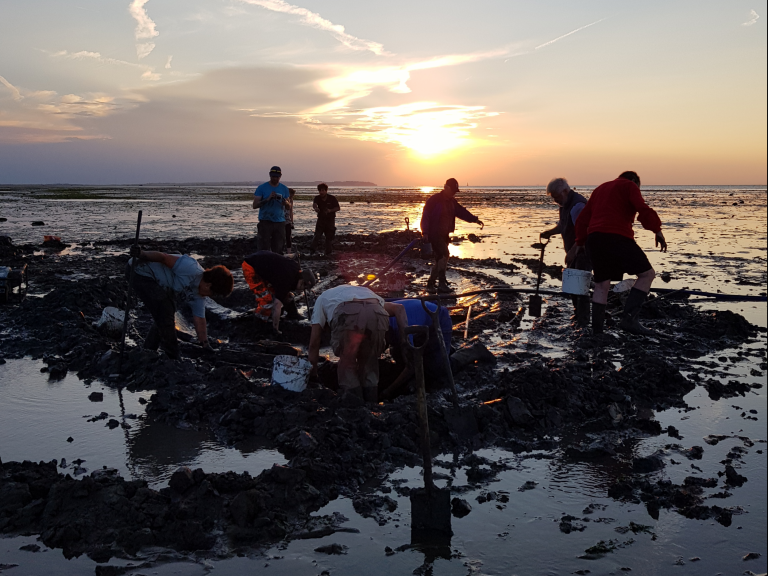
Members of Wessex Archaeology's Coastal & Marine team, along with Historic England, Timescapes, University of Wales Trinity St David and several volunteers have just returned from the excavation and recording of the recently scheduled monument of Tankerton Beach Wreck in the intertidal zone of Tankerton Bay, Kent.
The excavations took place between the 11 and 19 July at low tides during daylight when the wreck was accessible from the foreshore. A pre-disturbance survey was made of the wreck on the first day before any work took place. Excavation could then commence with the removal of sediment from within the wreck to expose the timbers that had been preserved within the London clay. Sediment samples were taken in significant areas of the wreck in the hope that they will provide further information once processed.
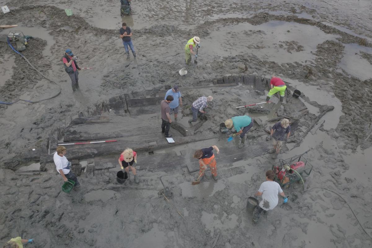
Tom Banbury, one of the volunteers was on site at every opportunity to take high quality aerial photographs with a drone, which gave a new perspective to the wreck and was a good way of seeing the extent and development of the excavations taking place.
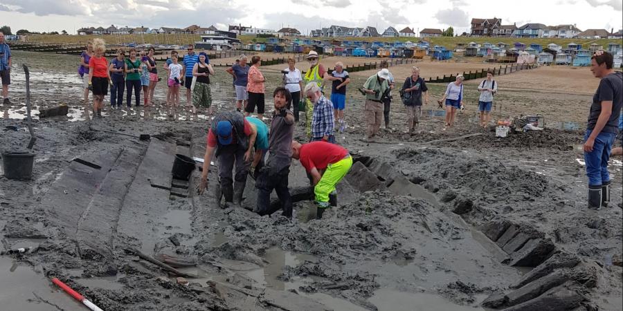
New areas of the wreck were excavated and revealed at every low tide. Once they were cleaned of any residual sediments, they were recorded through measurements and photography with scales. Dr Rod Bale, from the University of Wales Trinity St David was on site at all times to select relevant samples for dendrochronological analysis. Towards the end of our time on the wreck, ceiling planks, frames, and a (dislodged) knee were exposed, and part of the keelson that runs along the length of the vessel was uncovered.
On the last day, the wreck was reburied in the clay to preserve the timbers and to minimise the impact that the marine environment can have on the structure.
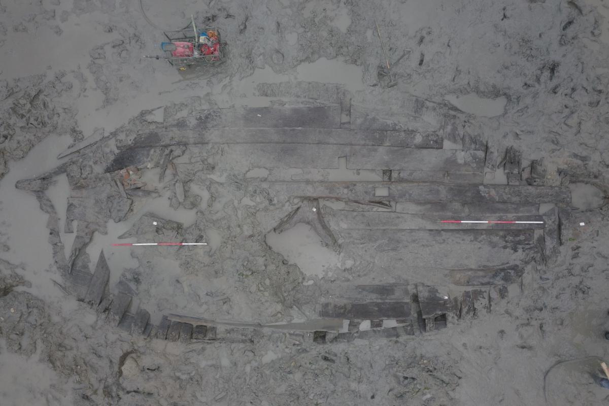
Aerial photographs courtesy of Tom Banbury