Much of the work to unravel Salisbury’s past has centred on the archaeology of the city and its medieval remains. However, our journey has acknowledged that people lived in the area long before the city was conceived. We therefore turn our attention back in time and where better to start than in the Iron Age (800BC – 43 AD) with the formidable defences of Old Sarum. This massive piece of civil engineering formed only one of several hill forts which are dotted around the locality, providing a statement of prestige and power as much as of military might. The visible ramparts were built about 400BC but, like Figsbury Ring, another hill fort, 5 kilometres to the east, the site may have had a much earlier beginning, possibly extending back into the Neolithic period. Old Sarum was subsequently adopted as an Anglo-Saxon mint before providing defences for the castle that was constructed following the Norman Conquest. The medieval town, which constituted a significant component in the story of Salisbury, developed here before moving to the present site.
Sadly, we know very little about the Iron Age settlement inside the ramparts; archaeological investigations at this important monument, which were mostly undertaken in the early parts of the 20th century, concentrated on the medieval castle, the foundations of the old cathedral and parts of the medieval town. The protected status of the monument has restricted archaeological projects within the castle but have included small scale projects related to its management (WA Projects 47666 and 52691). Work of this type demonstrates the diverse nature of modern archaeology. However, chance finds, including pottery and burials, together with more systematic excavations, have shown that Iron Age occupation extended beyond the hill fort, along the Castle Hill ridge to the east, overlooking the valleys of the Rivers Avon and Bourne.
Hill forts existed within a landscape which was also characterised by small farmsteads and field systems. An Iron Age enclosure, typical of many that must have been spread across the down land, was discovered in the mid-1860s when Salisbury was expanding beyond its medieval boundaries. This enclosure was located in the area between Highfield Road and Devizes Road on the ridge overlooking the confluence of the Rivers Avon and Nadder. The site was defined by a ‘V’ shaped ditch, 4.40m across and approximately 1.90m deep, which contained large quantities of Middle Iron Age (400BC – 101BC) domestic refuse in the upper fills. The site also contained a number of grain storage pits, which were then used for refuse. These pits known as the ‘Highfield Pits’, were thought by the Victorian antiquaries to have been prehistoric dwellings. Human remains were also found.
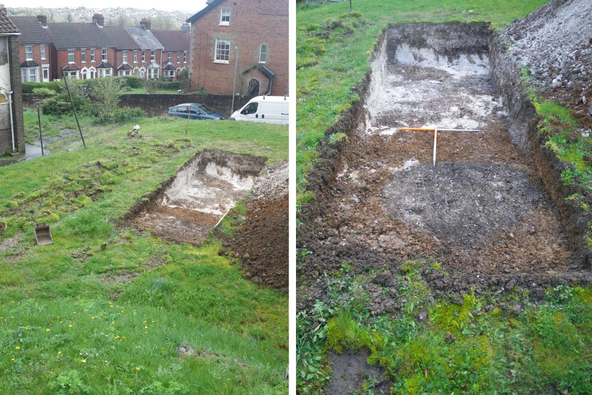
Archaeologists have been able to revisit the site as the Victorian properties have become available for redevelopment. These opportunities including work in Highfield Road and Devizes Road (WA Projects 47797 and 103640) have defined the extent of the settlement and increased the quantity of Middle Iron Age material from the ditch and pits. These excavations indicate that the ditch had been recut to create a feature with steep sides and a flat base at a later date, possibly during the Romano-British period and indicating that people had continued to occupy the site and maintain their lifestyle after the Roman invasion.

Left: excavations at Devizes Road (WA Project 103640)
Right: Trench 1, viewed from the west, uncovered three pits, including pit 109, clearly visible in the foreground as a dark grey circle
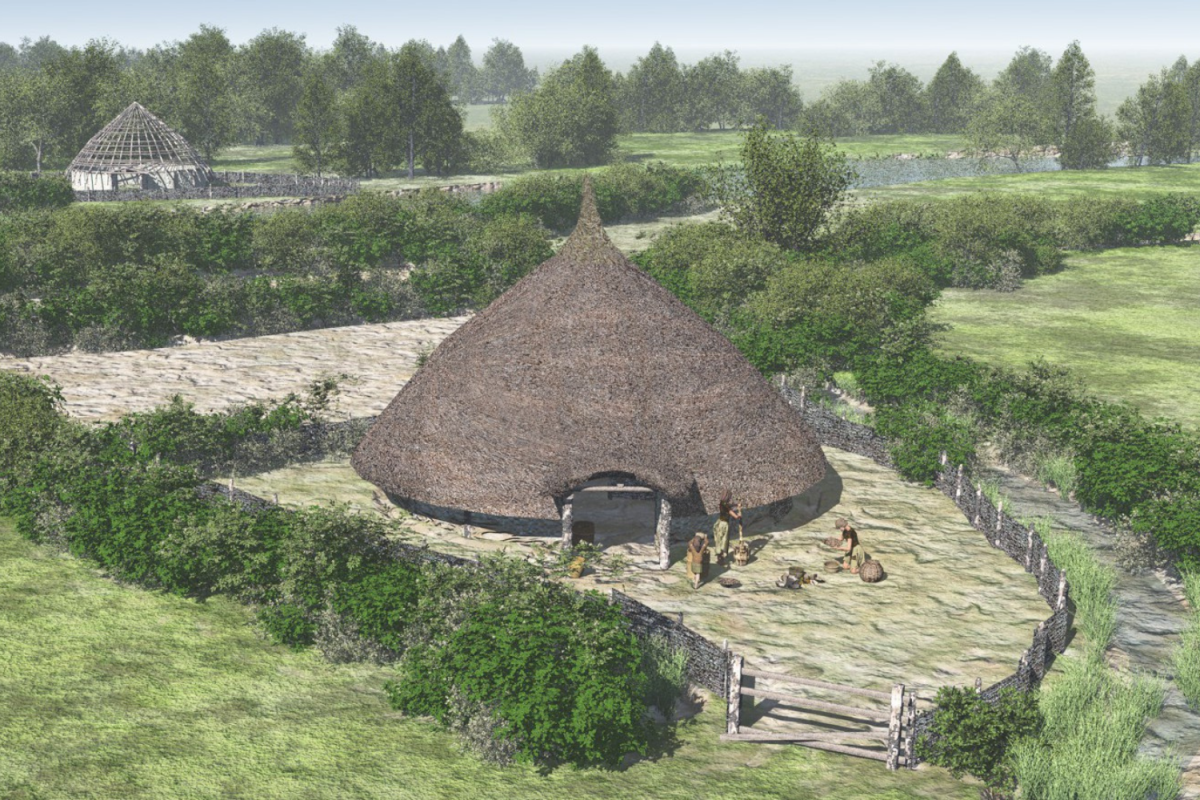
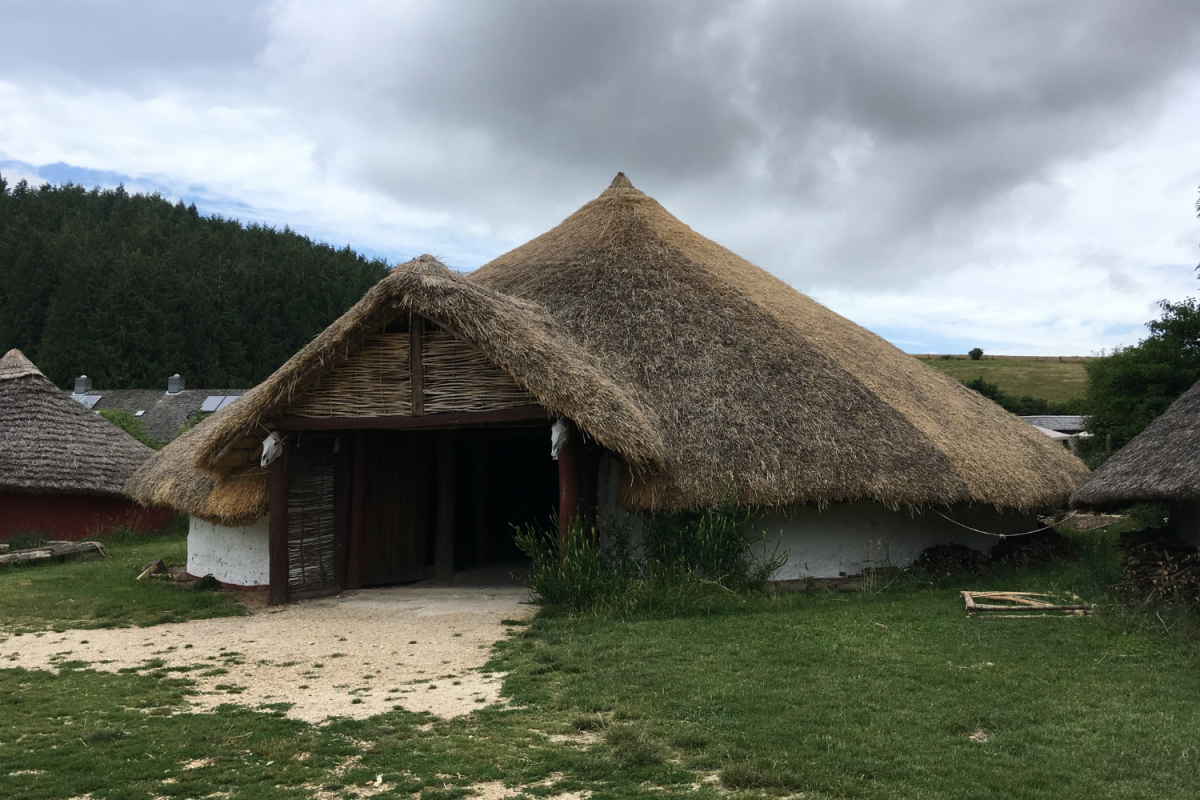
Traces of a similar Iron Age enclosure, the discovery of which made a profound impact on Iron Age studies in Britain, were found on the south side of the city. The site of this discovery lies just outside our study area but deserves mention nevertheless for its contribution to archaeology. The excavations, which took place at Little Woodbury in 1938 and 1939, were directed by Gerhard Bersu, a German citizen who emigrated from his homeland to escape the Nazi regime. The excavation adopted a strategy of exposing large open areas, which was revolutionary in Britain at that time. The results were profound; the technique revealed the first evidence of an Iron Age round house in Britain, refuting the idea that ‘ancient Britons’ were ‘primitive’ and lived underground in pits like the ‘Highfield pits’. Round houses have since been recognised as the norm for buildings of the Bronze and Iron Ages but were unheard of at the time.


Iron Age roundhouses: an artist's reconstruction (left) and a physical reconstruction at Butser Ancient Farm (right)
Subsequent excavations in the area at Rowbarrow (WA Project 57815) have helped place the enclosure at Little Woodbury in its wider context. This work found traces of contemporary agricultural use in the surrounding area, including a boundary ditch with fence-lines and quarry pits, possibly to extract chalk to make daub for walls. Excavations of ancient field systems may not appear rewarding, but they were nevertheless essential components of the landscape which help to place the enclosures in their surroundings. Most significantly nine Iron Age inhumation burials were also found, possibly former residents of Little Woodbury.
Iron Age inhumation burials uncovered at Rowbarrow (WA Project 57815)
A thin spread of Romano-British pottery, which was recovered from a ditch at the west of the site, indicated that the local Iron Age lifestyle continued into the Romano-British period. The area remained one of agricultural use, changing only to a medieval open field system that was depicted on 16th and 17th century estate maps.
