Last week we considered work at a site in the New Street Chequer. The results were not entirely satisfactory, because legislation did not then exist to safeguard archaeological remains within the planning process before any redevelopment took place. This omission was remedied by new planning guidance, introduced in 1991, which required that archaeological remains should be considered as part of the planning consent.
The Local Planning Authority implemented this policy when another part of the chequer, the Old George Mall, was redeveloped in 1994-1995. The subsequent excavations were limited in extent, due to the density of standing buildings that awaited demolition, but were, nevertheless, among the first to be undertaken in the city as a condition of planning consent, a system that is now standard. The potential was undeniable; the chequer fronted onto New Street where properties were, by implication, likely to be amongst the first to be developed in the new city. The archaeological investigations followed a now familiar process involving desktop study, to assess what was known about the area, evaluation, to identify sites of greatest archaeological potential, and excavation of targeted areas, to compile a comprehensive archaeological record of these areas before they were destroyed.
Three trenches were excavated on the street frontage. Area 1, which measured 16 x 10m, comprised the largest area and included a sample of the ‘back-lands’. It was located at the west end of the street near the High Street. The results in this area, together with those from Area 2, confirmed that conditions of preservation were good, with up to 1 m of stratified deposits surviving. Layers in Area 3, at the east end of the street, had been extensively disturbed by modern foundations and were poorly preserved. Nevertheless, the trenches all contained remains of shallow chalk and flint wall foundations, dating from the 13th or 14th century, with underlying layers to made-up and stabilise the ground. The foundations supported timber framed superstructures which were aligned parallel to the street. Each building was constructed with one room containing a sequence of compacted floor surfaces and hearths. Some rooms were subsequently subdivided, with later service ranges occasionally added at the rear.
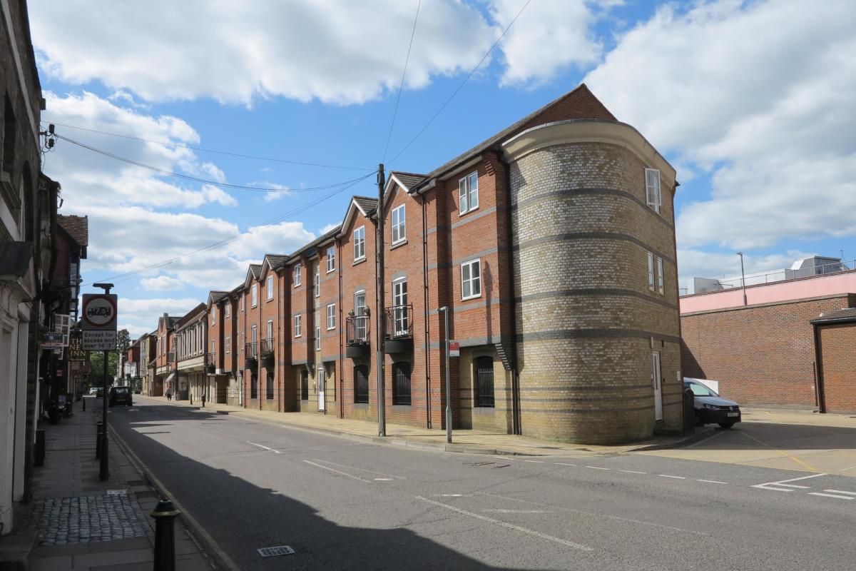
The Old George Mall site seen in 2020. Area 1 was located where the pedestrian can be seen on the left, and Area 2 was located by the apsidal building on the right of the image
All traces of later medieval redevelopment appear to have been removed by post medieval and modern redevelopment. However, as we have seen elsewhere as we have progressed through the city, properties often retained their original footprints into the later medieval period. Similar foundation patterns have been detected within what is now the New Inn, perversely the oldest building in the street, on the south side of New Street. This building once contained three properties, each with identical dimensions to those exposed in the excavations. It dates from the late 15th or early 16th century and probably encapsulates the outward appearance of medieval New Street.
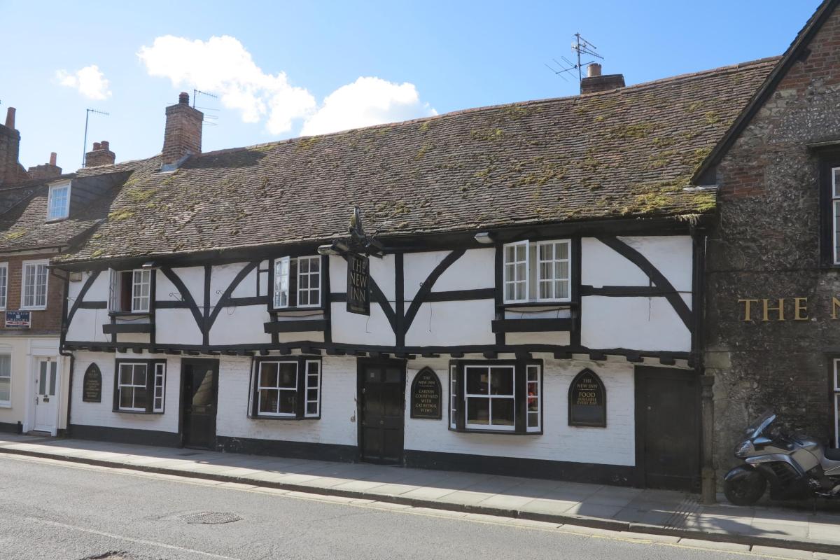
The New Inn, 2020, once three cottages, as can be seen by the repeating patterns of doors, windows and timber framing
The excavators concluded that buildings in New Street were essentially residential domestic properties, although the presence of highly vitrified fuel-ash slag with hammer-scale in Areas 1 and 2 hinted that the residents included metal workers who installed small-scale industrial or craft related workshops at their homes. This evidence, together with utilitarian building construction, the finds and environmental material suggested that residents were not of high status, in apparent contrast to occupants of properties on the north side of the chequer. Opportunities to excavate the ‘back-lands’ were limited but wells, cesspits, rubbish pits, drains and yard surfaces reflected patterns that repeat across medieval Salisbury.
The excavations marked an important benchmark in the archaeological process in Salisbury. A report on the work, published in 2005, considered that the areas of study had been too restricted in extent and too widely spaced along New Street to be useful. These limitations had made it impossible to analyse a single tenement in its entirety, make accurate comparisons with adjoining tenements or expand the study to include the development and character of the entire street. These reservations are valid; nevertheless, the excavations took place when the legislation involved in the archaeological process was in its infancy. The value of the results can now be appreciated more fully by the additional findings from more recent excavations in the city. Most importantly the work ensured that archaeological layers were documented before they were totally destroyed.


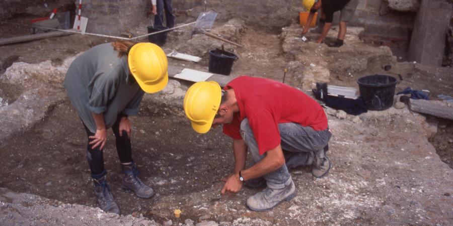
Area 2 of the Old George Mall site during excavations in 1994-1995, and the same view in 2020; the distinctively-shaped black sign and the timbered architecture of the New Inn can be seen in the background of both images
By Phil Harding, Fieldwork Archaeologist
Published results can be found on page 236 of Wiltshire Archaeological and Natural History Magazine 98, available to download here:
Do you want to support our work to share the story of Salisbury with the community? Please consider supporting our new film, Salisbury Uncovered.