We recently blogged about the German First World War submarine UC-70 and about how our survey work and advice helped Historic England to legally protect the wreck. However, this submarine is not the only nationally important shipwreck site to have been recently protected as a result of our work for Historic England.
In 2015 we undertook a survey of a much older and more mysterious wreck site off the infamous Chesil Beach in Dorset. The Shipwreck project, a Weymouth based community interest company that investigated the maritime heritage of the Dorset coast had found two groups of iron cannon just off the beach, about 200 m apart. We were tasked by Historic England to work with them to survey these sites and advise.
Chesil is a very dangerous and steep shingle beach miles long that is exposed to the full force of huge waves sweeping in from the Atlantic. These waves constantly alter the shape of the beach by churning up the shingle. Wooden ships caught in Lyme Bay in a storm and blown onto the beach are reputed to have disintegrated and been absorbed without trace into the top of the beach before the storm abated, only to be spat out again at the bottom of the beach during a storm years later. Ships are also reputed to have split in two as they hit the beach, with part of the vessel then drifting out and sinking a little further out.

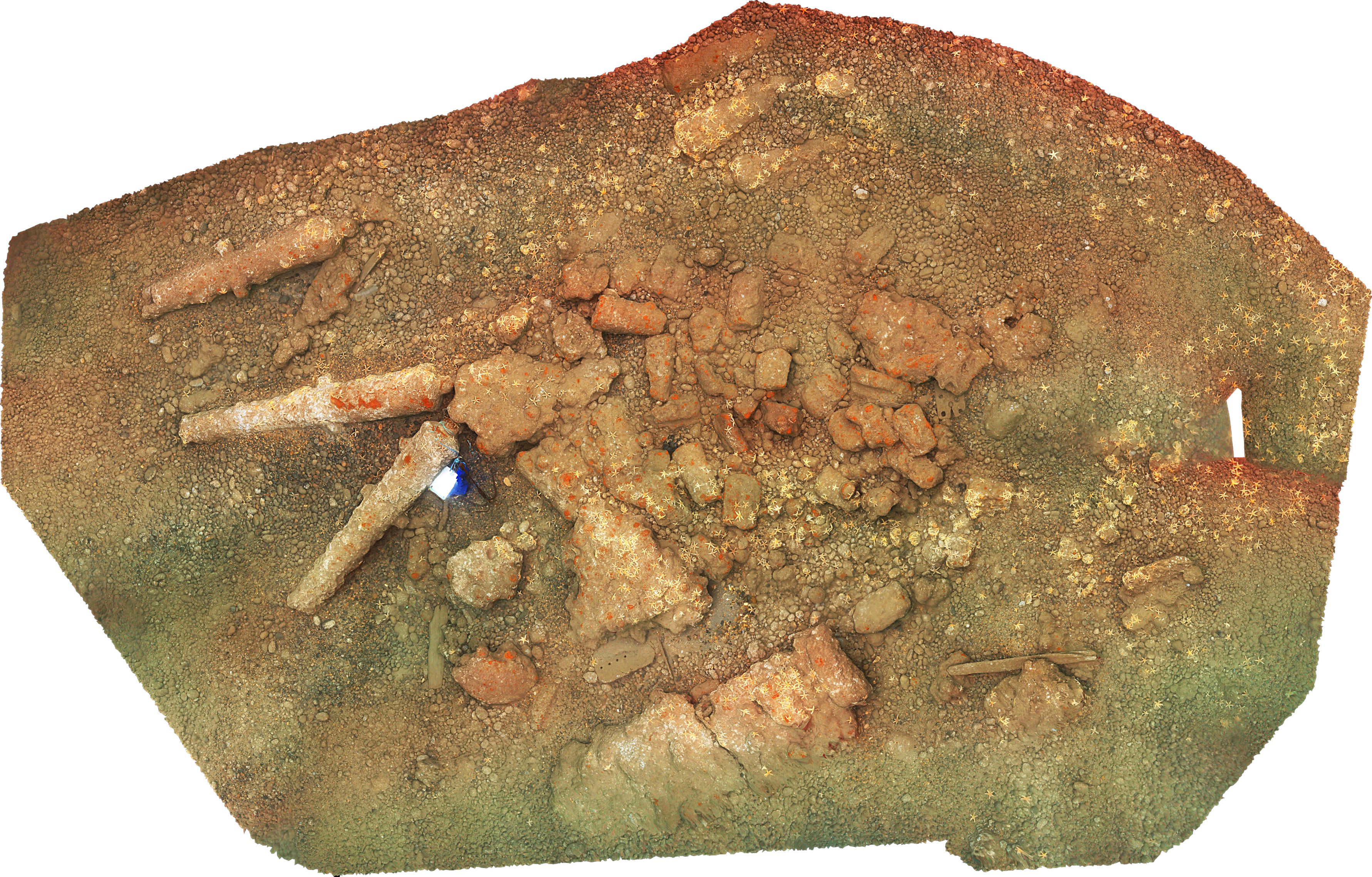
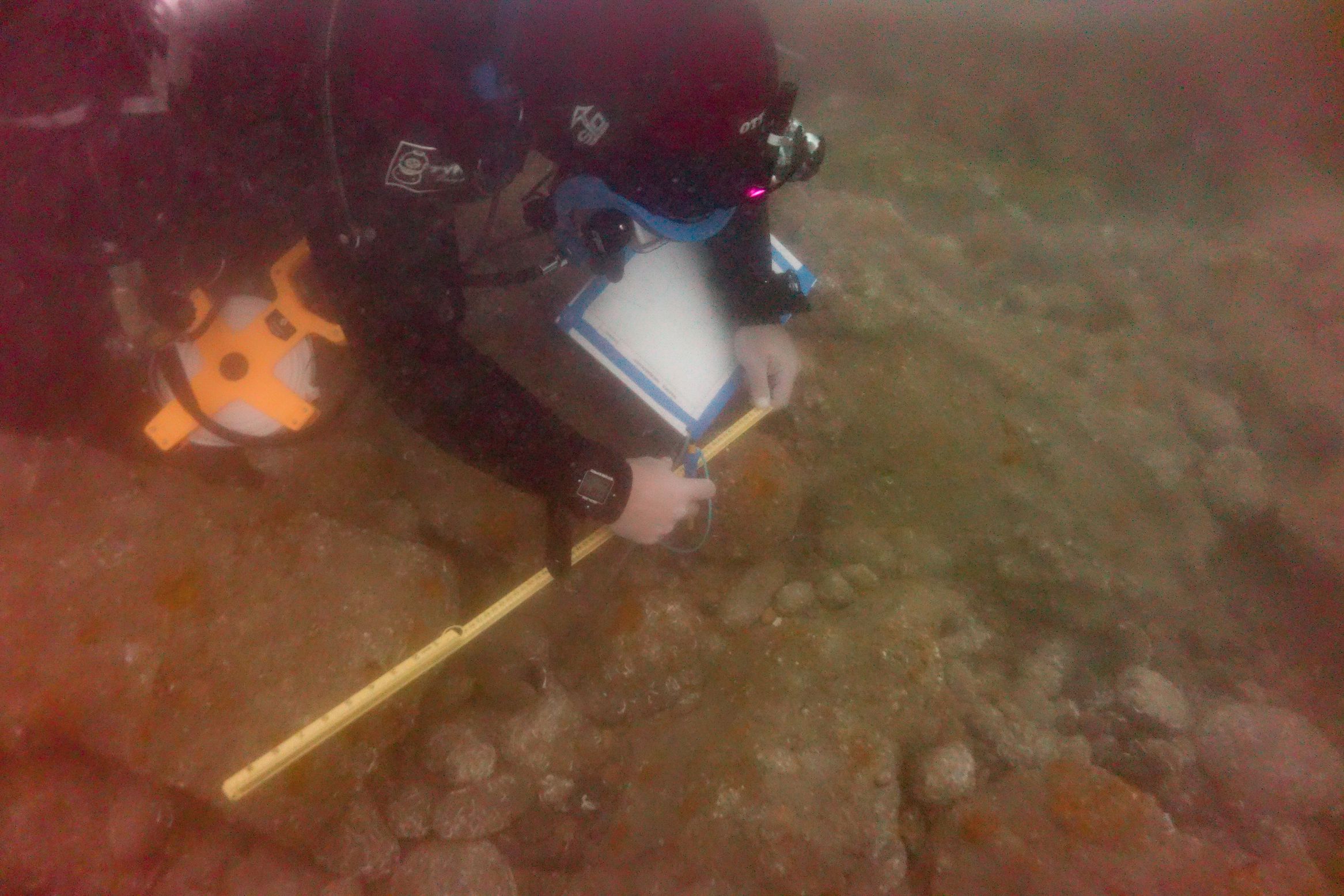
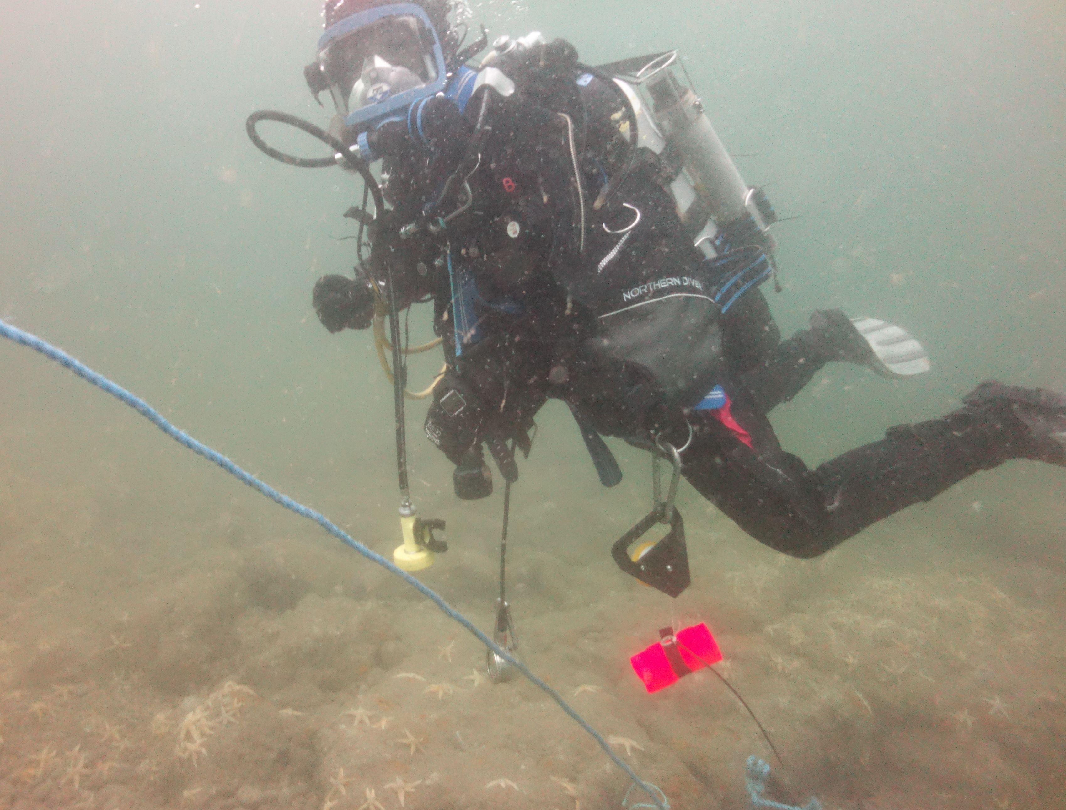
The exposed nature of the beach and the fierce tides that run along it, also mean that conditions are rarely good enough for archaeologists to dive there and that these dives are very short, often no more than 30 minutes. As we rarely get more than two or three days to work on any site, this means that we have to use recording techniques that are very quick and efficient, without losing the accuracy and reliability that Historic England and the public expects. As the ‘project lead’, I decided that using traditional measured survey would be too slow and would not produce enough information in the time available. I therefore decided to use photogrammetry, 3D modelling using photographs, a technique that Wessex Archaeology has been at the forefront of pioneering in UK marine archaeology. I tasked my archaeologist colleague and underwater photographer Paolo Croce to photograph both sites using a camera mounted on a frame held at a constant distance from the seabed by suspending it beneath a buoy floating on the surface. This enabled him to take several hundred photographs during a single dive on each site. A second diver took sample measurements to ensure that the models were scaled correctly. I then processed these photographs overnight using photogrammetry software. When satisfied that the resulting models were accurate, I transferred them to a digital drawing app on my tablet and the resulting site plans to traditional waterproof permatrace drawing sheets. As a result, for both sites I was able to send an archaeological diver into the water the next day with a complete and accurate site plan. All that was left for this diver to do on each site was to examine objects in the models that we had identified as being key to the interpretation of the sites.
Both sites remain unidentified and somewhat mysterious. Although there are many recorded losses off Chesil, we are not convinced that these two sites are related to any of them. It may therefore be that the sites are the remains of ships whose losses there are unrecorded or for which records have disappeared. However, with the help of ordnance expert Charles Trollope, we can say certain things about them. One of the sites, the closest inshore, has very large and probably English cannon manufactured between 1675 and 1715. These would only have been carried as the armament of a large warship. As no unaccounted large warship losses can be associated with the site and the guns are of different lengths, the likelihood is that these guns were not armament and were instead being transported as land or naval guns to an English colony or naval base. This was by no means unusual. For example, more than 400 cannon were sent to Barbados alone between 1660 and 1815. As well as the guns, we found large masses of cannonballs rusted together and the broken pieces of at least one gun. The latter led us to briefly consider the possibility that the site was a cargo of scrap iron that was inbound to England. However, the presence of the cannonballs suggested that this was not particularly likely. Furthermore, local rumour suggested that divers investigating at least one site with similar characteristics in the late 20th century had used explosives to break open large concretions which contained cannon. Unfortunately, the lack of records for these early investigations means that we are not able to positively link them with this site.
Thanks are very much due to Richard Bright-Paul and Grahame Knott of the Shipwreck Project, without whose work the investigations would not have been successful. Grahame has now moved on to found Deeper Dorset. We are also grateful to volunteer Royal Navy diver Oliver Penney and to archaeology student volunteers Lowri Roberts and Tom Harrison, both of whom have gone on to successfully work for Wessex Archaeology as marine archaeologists.