Wessex Archaeology diving operations on the wreck of HMS Montagu concluded last Sunday. The follow-on Help for Heroes diving operation, due to commence on Monday, was postponed due to the poor weather forecast for this week. The Montagu is under the cliffs on the west side of Lundy and becomes unsafe to dive or even manoeuvre a vessel in any significant westerly winds. You might be surprised by the fact that we chose to work in April, but local knowledge suggests that April and May have a good chance of easterly winds and the site is sheltered from these. April and May are also months in which the kelp forest, which covers and obscures the wreck in the summer, is relatively sparse.
As the weather restricted us to two days on site, it was vital for us prioritise the most important tasks. In heritage protection work at sea you need to know exactly where a wreck is and how far it extends across the seabed. Although many people have dived the Montagu and it is not hard to find (particularly when you have a local and very knowledgeable crew like ours − thank you Leigh and Andy), as far as we are aware it has never been surveyed in this way before. The Montagu wreck is also large, so it was very important that the survey was rapid. We therefore tracked our divers around the wreck with a USBL acoustic positioning system. By measuring the time it takes for an acoustic ‘ping’ sent by a transponder carried by each of our divers to reach a GPS linked transceiver mounted on the dive vessel and the angle and bearing to the transponder, the system works out in 3D where the divers are. So when our divers used their through-water communications equipment to tell us that they were, say, hovering over a section of armour plate, we could immediately plot the position of that object. As the divers swam around the site, we built up a map of how the wreckage was distributed. You can see the coverage we achieved on Sunday in the bathymetric image I have posted. Light blue is the area searched for wreckage, the grey/lilac is the area of wreckage predicted by our marine geophysicists. Where we found the wreckage corresponded remarkably well with their prediction.
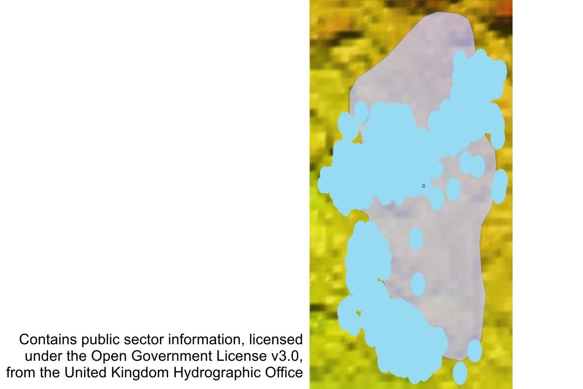
Bathymetry showing area searched, a probable revolving shell hoist well and 12-inch shells
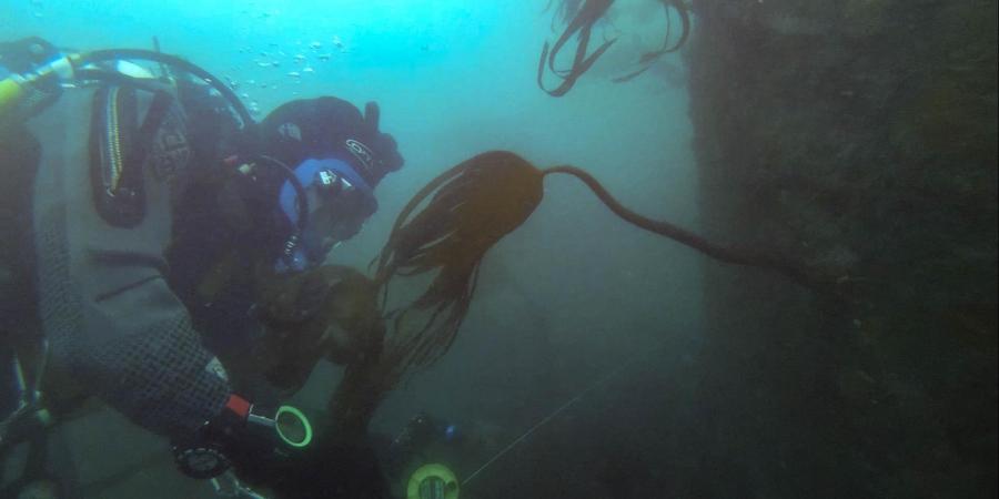
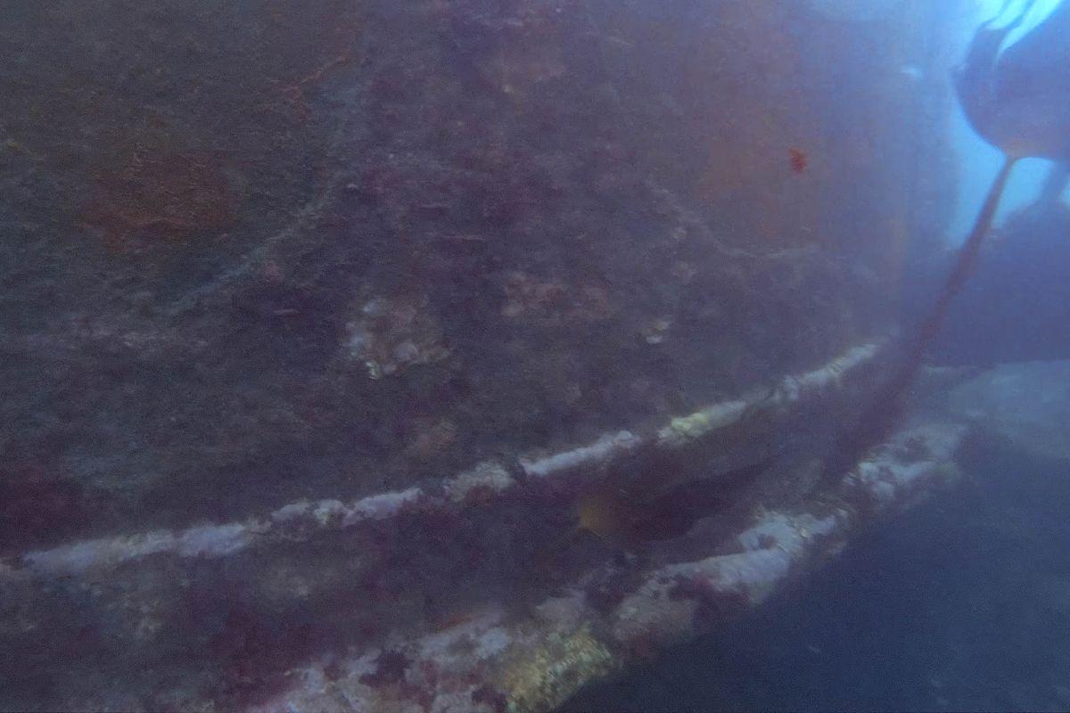
Much of the wreck comprises sections of armour plate and of the steel double bottom of the ship. One of the more interesting features was a large steel cylinder with a badly corroded floor. You can see the outer face of this cylinder in the first video still. Our initial theory is that this is likely to be the ‘well’ or bottom end of the revolving shell hoist of the ship’s forward 12-inch guns. However, we are not 100% certain because it has a wider diameter than the plans of Duncan class battleships built before the Montagu suggest. It was not uncommon for plans to differ from what was actually built, but this has given us cause for caution in our interpretation and we are going to have to consider what else it could have been when writing our report. The shell hoist would have connected the shell magazine in the bottom of the hold with the gun turret above.
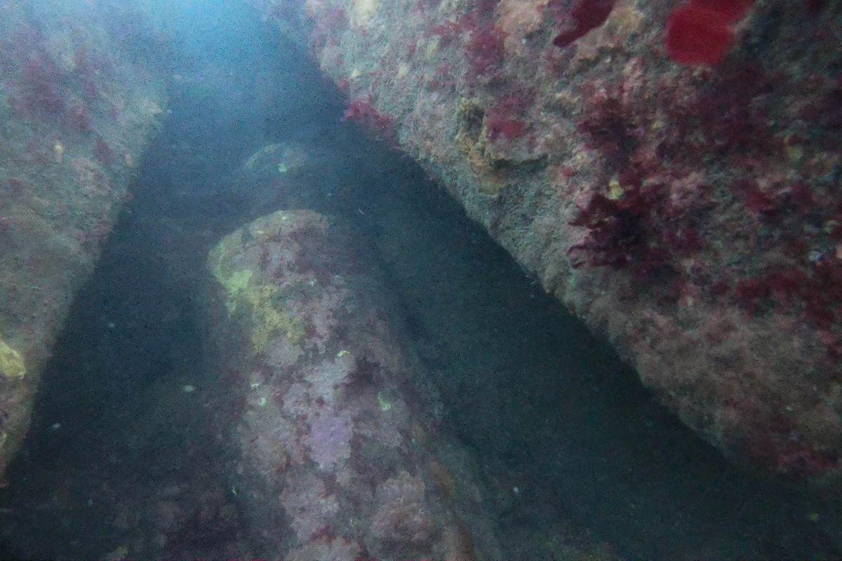
The other video still shows two of the shells that would have been transported in the hoist, partially buried between two large pieces of armour. Many of these shells are lying amongst the wreckage at the south end of the wreck and are likely to have been stored in the magazine for the after 12-inch guns. They are still potentially viable and my instructions to our divers were not to touch them and to maintain a wide berth once they had been photographed.
Much of the work that we had hoped to do on the Montagu, including non-destructive testing to monitor the wreck’s condition, will now be done when we return to the wreck with Help for Heroes. This will probably be in July, so please watch out for further updates then.