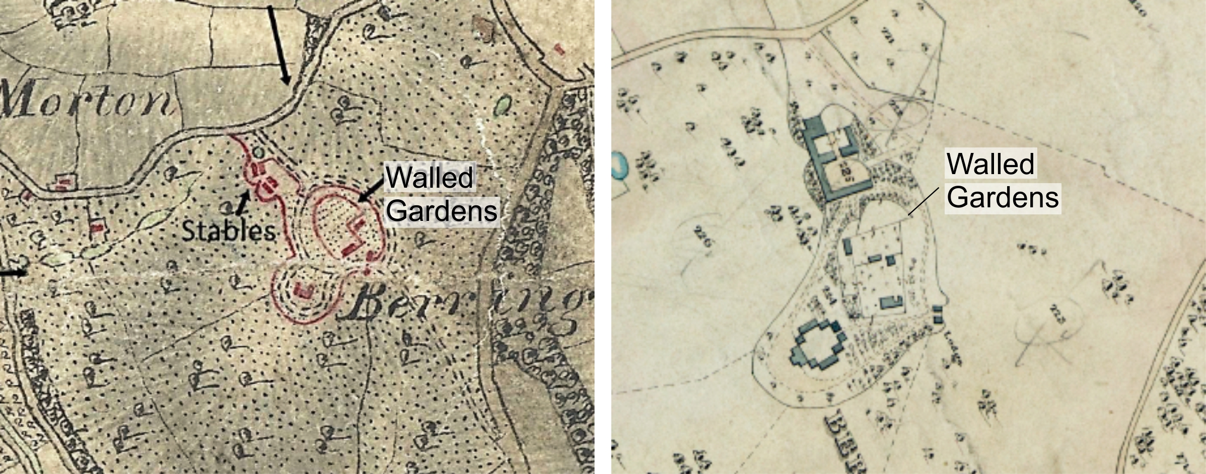
It is Lancelot ‘Capability’ Brown’s last great work, a sweeping landscape designed around an imposing stately home. At first glance it looks like many other Brownian sites, a haha surrounds the house, a long drive curves around to the entrance and there are beautiful views across wood pasture fields. But hidden in the corner is a rare and mysterious feature − a huge curved kitchen garden wall. Kitchen gardens are a common part of stately homes, and most of the surviving ones were built in the mid- to late 19th century and consist of a fairly standard quadrilateral design. However, an early Ordnance Survey map from 1815 shows the garden at Berrington as round (it looks a bit like an egg with the bottom cut off), but by the time the 1844 Tithe map was made most of it has disappeared and been replaced with a standard square design. Only the curved northern section remains.
The National Trust want to renovate the walled garden and need information to support their plans so they asked Wessex Archaeology to investigate. Did Brown really design a curved garden or is the early map just a bad drawing? If there was a curved garden who demolished it? When did they do it and why? We decided on a three pronged attack – examination of the structural remains, geophysics and of course, a few trenches!
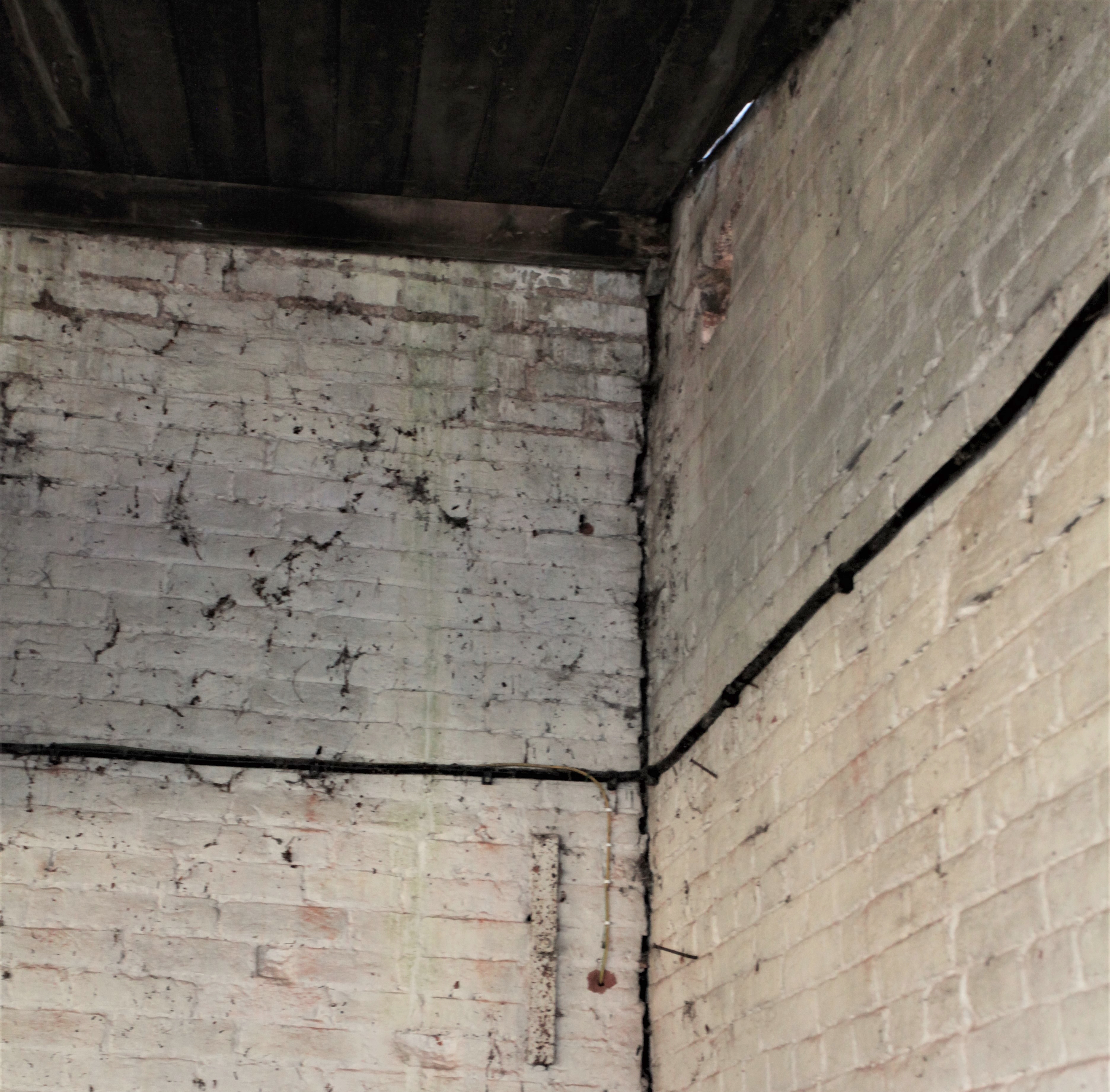
First the wall: straight away we could see that the curved part of the wall had been cut short and the rectangular wall built up against it; this implies that the curved wall is earlier. Also, the brickwork patterns in the curved wall and rectangular wall are different, which suggests they were built at different times. So it looks like the curved wall could be original Brown and the rectangular wall is a later. Next the geophysics: we picked up the remains of several old buildings and, more importantly, what looked like a continuation of the curved wall buried beneath the car park, so we put a trench right over it but found nothing! Perhaps all the old bricks had been removed and reused to build the new wall or perhaps the line visible in the geophysics was nothing to do with the wall at all?
Looking at all of the evidence, we still think its most likely that the curved wall is an original Brown design and the rectangular wall is later. Geophysics, old maps and even remains in the ground can sometimes be misleading and it’s up to us, the archaeologists, to make a decision. Perhaps you disagree… some old maps and photos are included here, what do you think?