As we progress towards the central market square, the economic hub of the medieval city, we arrive at the Three Swans Chequer. Documentary sources indicated that this location attracted potentially wealthy owners, including the Weaver’s Guild, who acquired revenue from wool.
The site, which had been the former Salisbury Bus Station, extended across the full width of the chequer and occupied two medieval tenement blocks, 8 and 10, on Endless Street and three, 13, 15 and 17, on Rollestone Street. When the bus station was closed the land was sold for redevelopment as retirement homes. Most of the site was taken up by parking bays and it was believed that only one other building had occupied the Endless Street frontage following the demolition of the medieval buildings and the construction of the bus station. The project therefore offered a rare opportunity to examine potentially well preserved archaeological layers near the economic hub of the medieval city.
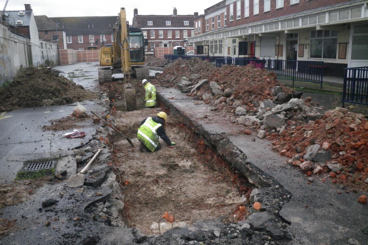
Four evaluation trenches, each 20 m long, were excavated in 2014 across all parts of the site to establish the presence and condition of any archaeological remains and their potential importance. The results were positive and confirmed that well preserved building foundations were present along both street frontages and that further, more extensive, excavations would be necessary before construction could begin.
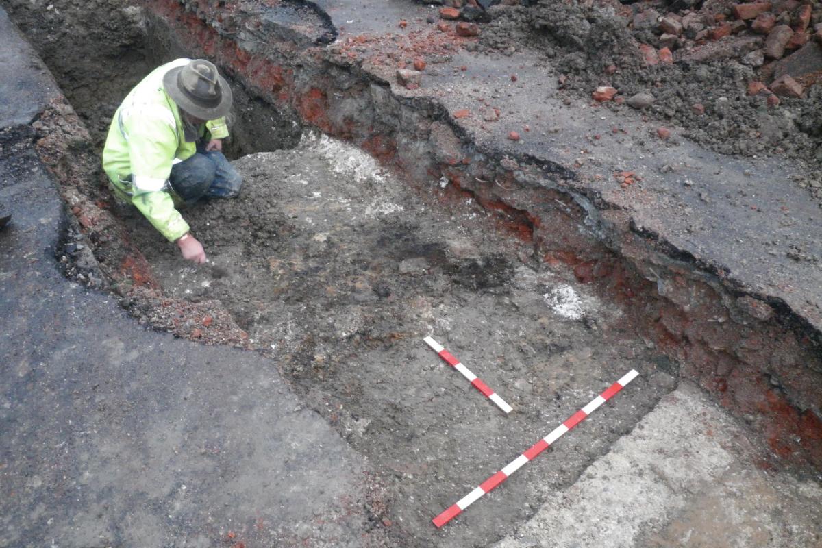
The first buildings appear to have been erected on Endless Street in the 13th or 14th century as indicated by pottery, which was found in the foundation layers. These fragments were made from coarse sandy clay, a type of pottery that was produced in kilns at Laverstock and is common across the medieval city. Many of the sherds were characterised by scratch marking, a distinctive treatment of the surface which indicates a probable 13th century date and suggests construction here from the earliest dates in Salisbury.
The distribution and ground plan of the foundations suggest that two parallel ranges of buildings were represented on Endless Street, one positioned along the street frontage and the other approximately 30m to the rear, across the central part of the chequer.
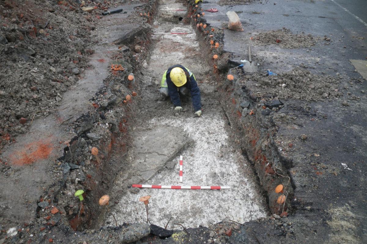
Foundations on the street frontage were of chalk and flint construction which undoubtedly provided a base for timber framed buildings, the prevalent construction technique in medieval and late medieval Salisbury. It is quite likely that this building was sufficiently important to have been built with a large open hall with central fireplace. Internal wall lines were identified with insubstantial partition walls. Clay floor foundations and rammed chalk floor surfaces were also preserved. These were very clean and so may have supported stone or tiled floors.
The central range measured 6m across and was also timber framed with a spinal wall beneath a central ridge. The construction of the range, whether single or multi story, and its function, as out-buildings, workshops or residential, could not be determined. Internal walls and floor foundations were identified but no floor surfaces survived.
These two ranges hinted that the entire complex may have been constructed around a central courtyard, a design of high-status residence which is known in the city, but none previously excavated. This ground plan fits with that shown on early maps of Salisbury in Speed’s rather stylised edition of 1611 and the more elaborate plan compiled by Naish in 1716. The level of detail shown may confirm the importance of this building.

These medieval buildings were demolished in approximately 1740 and were replaced by an imposing brick structure with a large open space across the central part of the chequer. This building was itself demolished to make way for the bus station.
Buildings appear to have been erected on Rollestone Street by the 15th-16th centuries, with modifications in the 17th century. These buildings also appear on Naish’s plan and were of similar construction with flint, chalk and Greensand foundations with internal dividing walls, clay floors and external yards. The findings support similar results from excavations immediately to the south on Rollestone Street in 1988 where, as we will see next week, traces of medieval walls indicated similar early occupation in the street. The buildings were also aligned on the rear elevation of the existing building at 19 Rollestone Street, immediately to the north. It shows that for much of their existence buildings probably occupied a largely unchanged footprint from the time when they were laid out.
Land to the rear of these buildings, commonly known as the back-lands, were, in common with many parts of Salisbury, maintained as open yards and gardens.
More detailed excavations were undertaken by Cotswold Archaeology before the site was redeveloped. The results are due to be published in a forthcoming volume of the Wiltshire Archaeological Magazine.