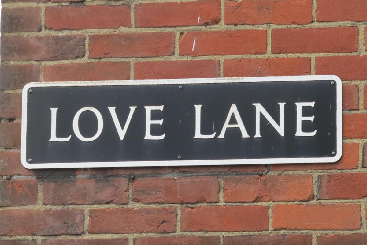
Many of Salisbury’s streets bear unmistakable links with trades and professions of the sort perpetuated by Fish Row and Butcher Row. These names carry useful hints of their medieval roots and local inhabitants; such being Love Lane, which has traditional links with the city’s ‘red-light’ district.
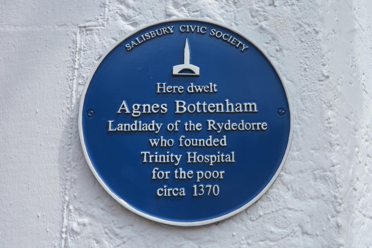
It may come as something of a surprise to find that such a profession flourished in the cathedral city; however, prostitution was relatively common in many medieval towns and cities and was tolerated. It was viewed as a means by which to control other forms of violent physical and sexual exploitation. As the city was owned by the bishop it is a fair bet that the church was not only aware of its existence but may also have benefitted, not merely financially. We even have the luxury of a named person who was associated with the trade. Agnes Bottenham ran a brothel and was subsequently suitably contrite as to invest her profits into philanthropic work by the creation of Trinity Hospital. This institution provided shelter and care for the poor and was located in Trinity Street, adjacent to Love Lane. It was itself built on the site of a former brothel in the late 14th century, indicating that prostitution in Salisbury is almost as old as the city itself.
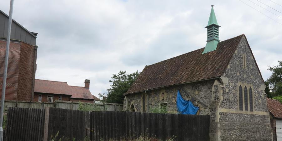
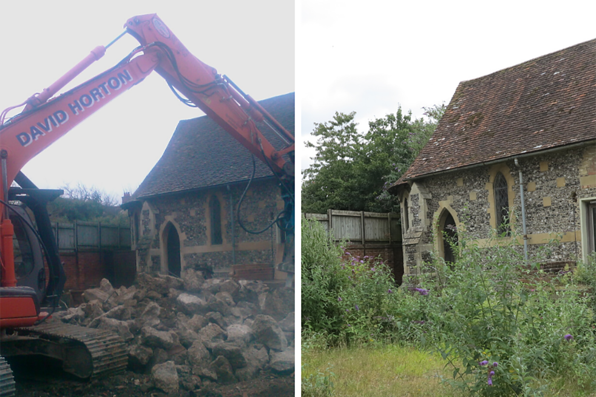
This titillating connection with Salisbury’s steamy past aside the location in Love Lane warranted attention for its archaeological merits within the medieval city limits. The Wiltshire County Archaeological Service therefore requested that an archaeological watching brief should be undertaken when the existing buildings were demolished. Proposals were made to replace them with three terraced houses with conversion of the neighbouring St. Luke’s Chapel.
The fieldwork was limited; however, removal of part of the perimeter foundation created a slot that was 14m long, 1m wide and between 1.2 and 1.35m deep. This showed that the ‘back-lands’ were covered by a typical blanket of garden soil which contained sherds of post medieval pottery. Two probable pits, both undated, were exposed in the side of the trench and were sealed beneath the garden soil. Up to three wall foundations, which probably marked the rear elevations of the street frontage properties, were exposed where the plot fronted onto Love Lane. The two earliest foundations were constructed of flint and mortar and lay either side of a later chalk foundation which was associated with a spread of chalk which provided the base for an overlying floor.
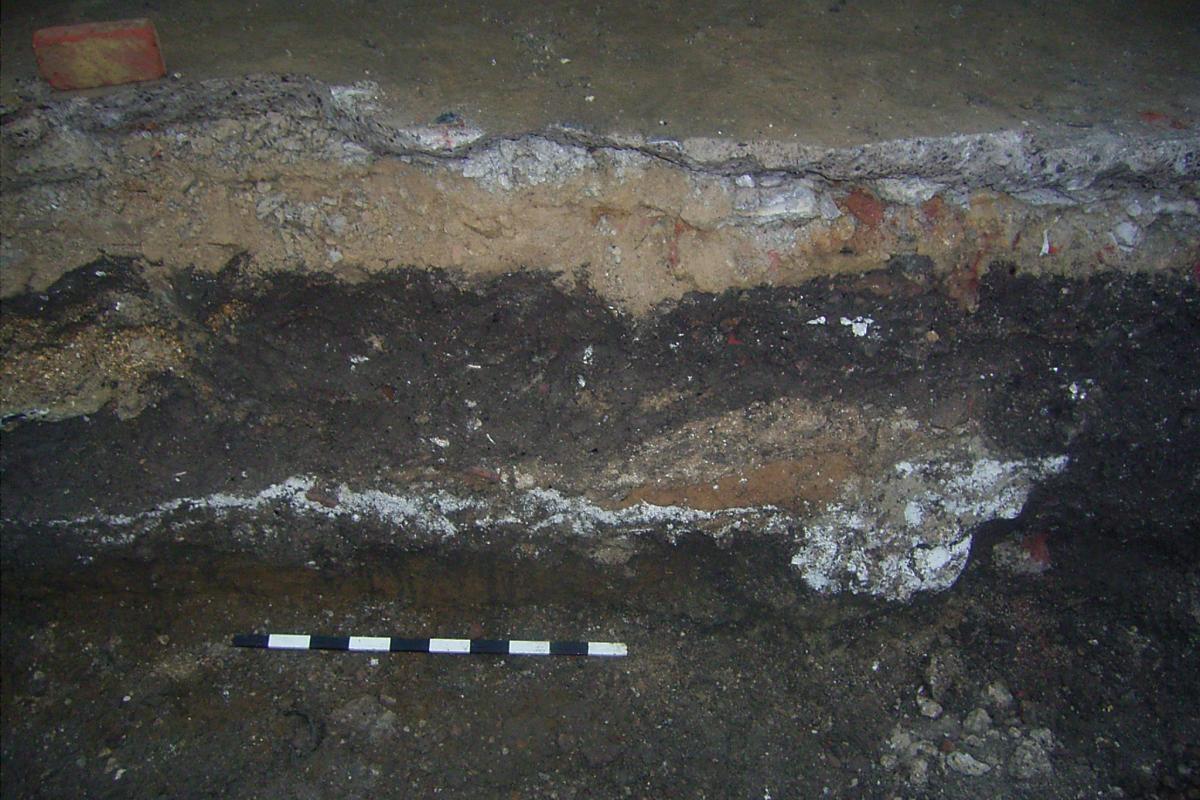
No datable material was found; however, these rather slender traces are immediately reminiscent of the medieval and early post medieval foundations which have been found in Salisbury. Speed’s map of 1611 indicates buildings being present on the site, although by 1716 when the city was surveyed by Naish the site is depicted as being vacant. The process whereby some tenements can be cleared and remain undeveloped for long periods of time persists – the site awaits redevelopment.
Sadly, no evidence was found to illustrate the potentially colourful professions of the former occupants of Love Lane; a trade that produced few distinctive artefacts. This dilemma is not unique; we know from historic documents that the city economy was founded on wool. Weavers abounded, but like prostitutes, created no tangible signs of their profession for the archaeologist to recover. Despite these frustrating problems we have seen as we pass through the streets of the city that many of Salisbury’s medieval residents were practical people, manufacturers and creators of goods. Tanners, leather workers, metal workers, cutlers, armourers and horn workers also thrived; trades for which we can find evidence in distinctive artefacts. We have seen examples of craft residues including a pit filled with a horse skulls at the ATS site, probable horn working debris and fulling tanks at Brown Street, hammer scale from smithing at New Street and clay tobacco pipe wasters in Salt Lane. We have also noted that archaeological excavations have also revealed traces of heavy industry, including a foundry and a pottery kiln on Guilder Lane, both arguably located on the eastern, lee side of the prevailing wind, where they reduced the fire risk to the city. These creative crafts were all underpinned by the merchants who conversely created few signs of their professions, except, as we hinted at New Canal, might be recognised by exotic imported goods. These examples demonstrate the wide range of sources that can provide archaeologists, historians and visitors alike with information on former creative and recreational professions that created a vibrant city.